
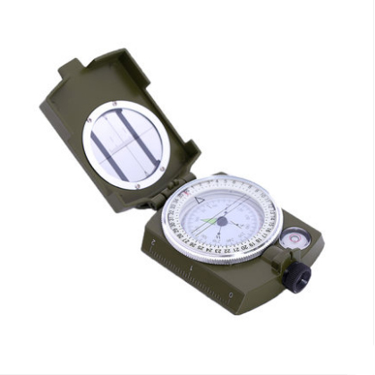
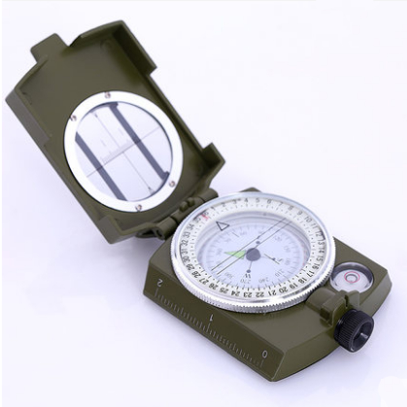

High-grade American army green compass
1. Azimuth measurement: Ones, rotating bearing box on bearing glass scale line and direction indicators are relatively, put (45 °) the head-up mirror inclined monocular by accuracy aiming target, see magnetic N pole from the smooth inspect mirror reflection bearing partition on the word table card, can read the target azimuth, and then turn the bearing box with his right hand on bearing glass scale line aim with the magnetic N pole, the direction indicator and azimuth Angle of glass scale line between is the target azimuth (clockwise). Open the compass needle, calibrate the map (no map can be demarcated when ranging), insert a needle in the reference point of the map, turn the compass needle, make the side ruler edge cut at the target point, then the azimuth Angle from the reference point to the target point can be interpreted. 2. Calibration map: Ones, rotating bearing frame, make the bearing box and direction indicator on the scale line on the word (note the magnetic declination correction), put behind the flat map, thumb side toward the map in the arctic, the coordinates of ladder feet long and the magnetic meridian tangent maps, the map make the magnetic N pole alignment is rotated the scale lines on the glass, the map that has been calibration. 3. Find the marching direction towards the covered target: Expand the north needle on the map, so that the mapping ruler through the map on the foothold and march target, then the direction indicator refers to the direction of the march. Rotary bearing box make azimuth direction of the (S, N) on the glass with the (S, N) in the same direction on the map, and then write down the direction indicators referred to in azimuth readings, facing the direction indicator picked up behind the rotating body, make the magnetic N pole and bearing glass scale line alignment, aim through interior photo forward at this time, in this on line all objects (such as trees, houses, etc.) can be used as a secondary target marching direction, realize the auxiliary to before into after target. Close the compass needle into a bag, but do not turn the azimuth box, after reaching the auxiliary target can find a new auxiliary target to continue to move, until the destination, along the way should check the direction reading. 4. Given the distance between the target and the standing point, estimate the distance between the target and the standing point: (1) take aim at the target through the door and the left and right points of the alignment, according to the multiple of the width between the left and right points of the alignment according to the interval of the target, and estimate the distance of the target according to the proportion formula of 10:1. The distance between the target and the standing point (m) = the width of the target interval (m) x10/ the distance between the target is a multiple of the width of the two front tips of the alignment There is a highway ahead parallel to our position. Find the distance between the highway and our position. There are electric poles along the highway. The distance between the poles is 50 meters. The distance estimator is used to measure that there are 5 electric poles at the left and right tips. According to the proportion formula: The distance between the road and the position =50x10x4= 2000m
(2) use the auxiliary point to find the distance of the target Aim at the target with the gate alignment, turn the azimuth frame so that the scale is on the N pole of the positive needle, and record the azimuth reading indicated by the direction indicator. Then turn left or right in an angular direction (i.e., 15-00 away from the original azimuth reading) to find an auxiliary point and measure the distance from the auxiliary point to the standing point by foot or other means. At the auxiliary point, use the north needle to align with the original target through the alignment gate. Similarly, turn the azimuth frame to make the scale line align with the N pole of the magnetic needle, and record the reading indicated by the direction indicator. According to the difference between the front and back direction Angle readings and the distance from the standing point to the auxiliary point, the target distance can be obtained in schedule 2. If the difference between the above two directional Angle readings is 7-50 (i.e., 45°), the target distance is equal to the distance from the standing point to the auxiliary point.
5. Measurement of pitch Angle: Face down, take aim at the target with the gate alignment, and reflect the pitch Angle reading through the level mirror; Or to stand on a plane and measure the tilt of the plane. 6. Height measurement: Measure altitude with maps and altimeters. The horizontal distance from the standing point to the target can be found on the map, and the pitch can be measured by the north needle. Find the height from the bottom of the mountain to the top. Find out from the map that the horizontal distance between the peak and the standing point is 100 meters. Use the north needle to measure the elevation of the peak is 40°.
7. Measure the distance between any two points on the map: The formula for calculating the relationship between the edge length of the square li net and the distance on the spot of maps with different scales
1:25,000 map: distance = (mm measured /4) X100 (m) 1:50,000 map: distance = (mm measured /2) X100 (m) 1:100,000 map: distance = mm measured X 100 (m) 8. Magnetic deflection measurement: (1) the direction of the earth's north and south magnetic poles is not exactly in the earth's north and south direction, so the needle points to the north and south direction, and the real north and south direction has a deviation Angle, the deviation Angle is called magnetic deviation Angle, its value varies from place to place. When do not need accurate measurement, the direction indicated by the magnetic needle can be regarded as true north, in need of accurate measurement, first check the location of magnetic declination book, and then according to the direction indicated by the north needle, calculate the true north-south direction. If the compass needle is used in changsha, check the magnetic deviation Angle of changsha in appendix 4 is 2°41' (W), that is to say, the north indicated by the magnetic needle in changsha is 2°41' to the west of the north.
(2) anywhere magnetic deflection Angle method. On a clear night, unfold the compass needle and turn the bearing frame so that the (N) character on the bearing glass is facing the direction indicator. With the door, alignment, eye level mirror and luminous signs are on the north star, unchanged needle direction, the needle will be flat, at this time the needle North Pole point reading is the location of magnetic declination Angle.
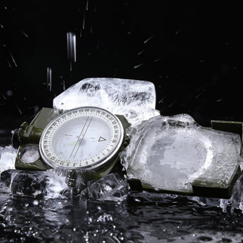
Maintenance: 1. Do not approach ferromagnetic objects, high voltage wires and electromagnetic devices when using and placing the compass needle, so as to avoid errors and reduce the sensitivity of the compass. 2. When not in use, keep in a ventilated and dry place to avoid mildew. 3. When the surface is dirty, white flannelette can be used to wipe the surface gently to keep the surface smooth and clean. The company mainly engaged in magnifying glass, compass, telescope and so on. Company adhering to the \"customer first, forge ahead\" business philosophy, adhere to the \"customer first\" principle to provide quality services for our customers. Welcome!
The company mainly engaged in magnifying glass, compass, telescope and so on. Company adhering to the \"customer first, forge ahead\" business philosophy, adhere to the \"customer first\" principle to provide quality services for our customers. Welcome! The company mainly engaged in magnifying glass, compass, telescope and so on. Company adhering to the \"customer first, forge ahead\" business philosophy, adhere to the \"customer first\" principle to provide quality services for our customers. Welcome!
Generally: crossed price: crossed price may be the guide price of the goods or the goods have been shown the sale price, not the original price, only for reference. Uncrossed price: the uncrossed price is the sale price of the commodities on alibaba China website. The specific transaction price will be subject to the price on the order settlement page depending on the participation of commodities in activities or the use of coupons by users. Under the preheating state of the activity: crossed price: crossed price is the sale price of the commodity in the current preheating state of the activity, not the original price. The specific transaction price may change due to the use of coupons by users, and the final price on the order settlement page shall prevail. Uncrossed price: the uncrossed price may be the price that the commodity is about to participate in the activity, only for reference. The transaction price of the specific activity may change due to the user's use of coupons, and the final price of the activity is the price of the order settlement page.* note: the foregoing is valid only when a price comparison occurs. If the business to underline the price alone, the statement of the business to prevail.


